Key points
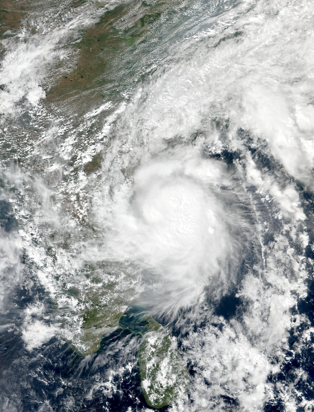
- Severe Cyclonic Storm Murasu began its landfall process at 1am on Tuesday 3 November near Ongole in Andhra Pradesh, the India Meteorological Department said, with sustained winds of 100 to 110 kilometres per hour and gusts up to 120 kilometres per hour.
- The storm's eye was touching the coast at 4:16am and entering the coast at 5:08am, the department said; by 5:30am the centre was 20 kilometres from Ongole and landfall was expected to take about two more hours to complete.
- Hundreds of trees were uprooted in Nellore, Prakasam and Bapatla districts and several low-lying areas were inundated, the Indian Express reported, while the electricity department reported no fallen power poles and no disruption to supply in the affected zones at the time of its early-morning update.
- No deaths had been reported in the sources checked at the time of publication; about 2,000 people had been evacuated on Monday and the state disaster management authority planned to move about 30,000 people in total, its managing director told Reuters.
Severe Cyclonic Storm Murasu has begun coming ashore on India's east coast, bringing heavy rain and gale-force winds to Andhra Pradesh less than a week after Cyclone Arnab struck the same coastline. The India Meteorological Department said the landfall process commenced at 1am on Tuesday 3 November near Ongole, in Prakasam district, with the storm moving north-northwestwards from the west-central Bay of Bengal. Read more: Cyclone Arnab kills three in Andhra Pradesh as storm makes landfall on India's east coast
At the landfall point, the department reported observed maximum sustained winds of 110 to 120 kilometres per hour, The Hindu reported, while its forecast range for the crossing was sustained winds of 100 to 110 kilometres per hour with gusts reaching 120 kilometres per hour. A storm surge of 1.0 to 1.5 metres above the astronomical tide was forecast to inundate low-lying areas of the south coast, with the peak surge expected over Bapatla and parts of Krishna and Prakasam districts, India TV reported, citing the department.
A slow, drawn-out landfall
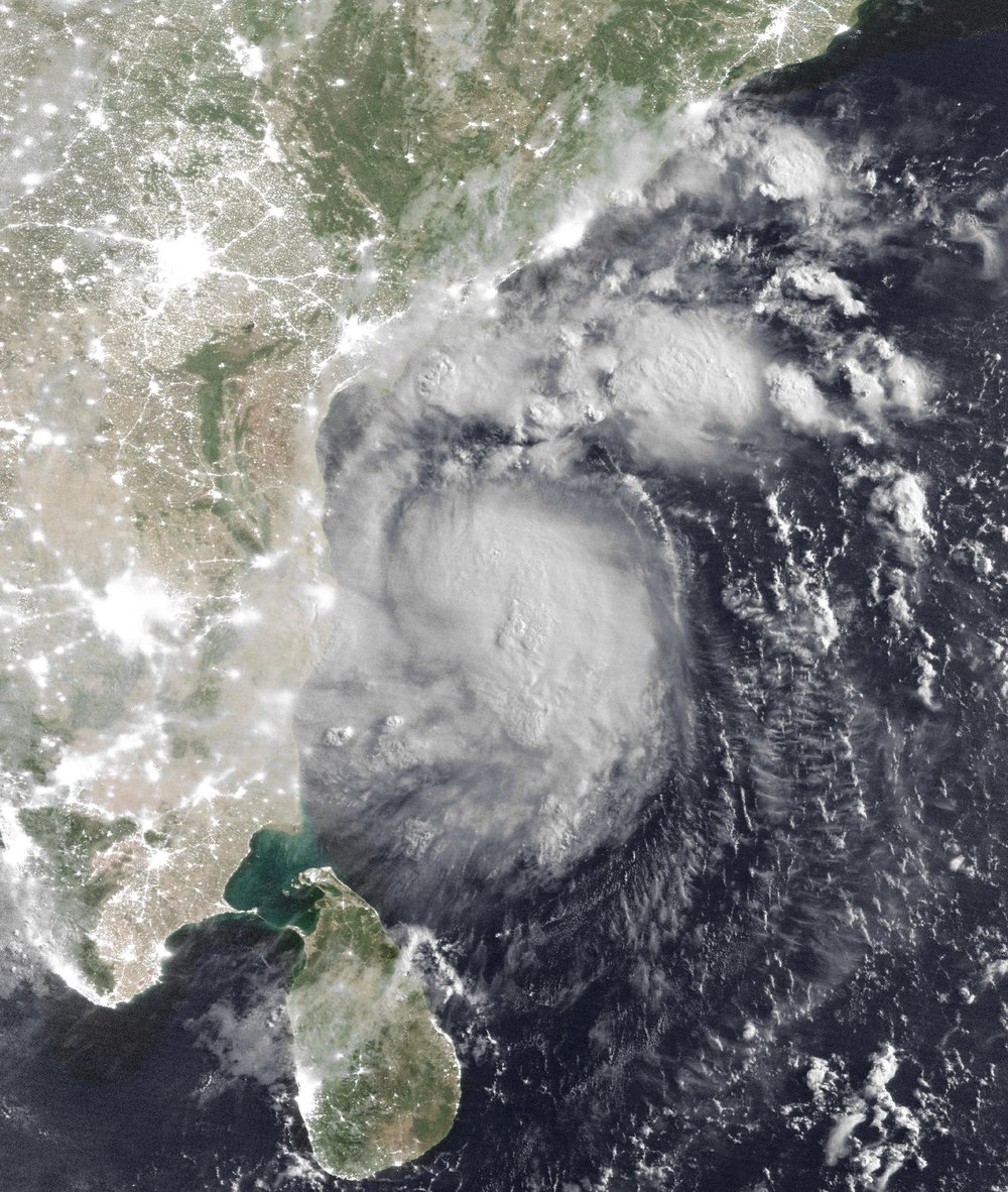
Landfall for a cyclone is a process, not a moment: it ends only when the whole centre of the storm has crossed the coast. Murasu's has been slow. At 1:30am the centre was about 40 kilometres southeast of Ongole, 60 kilometres northeast of Kavali and 70 kilometres south of Bapatla, the department said, as reported by The Hindu. By about 3am it was about 30 kilometres southeast of Ongole, with the wall cloud — the ring of strongest winds around the eye — moving onto land.
The eye itself was touching the coast at 4:16am, the department said on X, and was entering the coast at 5:08am, with most of the wall cloud already on land. An update received at 5:30am put the centre 20 kilometres from Ongole, 60 kilometres from Bapatla, 70 kilometres from Kavali, 110 kilometres from Nellore and 130 kilometres from Machilipatnam, moving at 9 kilometres per hour over the previous six hours, The Hindu reported — with the landfall process expected to be completed in another two hours, later than the department's first forecast window of 11:30pm on Monday to 4am on Tuesday.

The key figures
| Measure | Figure | Source |
|---|---|---|
| Landfall process began | 1am IST, 3 November 2026, near Ongole | India Meteorological Department |
| Sustained winds at landfall | 100 to 110 km/h | India Meteorological Department |
| Gusts | Up to 120 km/h | India Meteorological Department |
| Observed maximum sustained winds at landfall point | 110 to 120 km/h | India Meteorological Department, via The Hindu |
| Storm surge forecast | 1.0 to 1.5 m above astronomical tide | India Meteorological Department, via India TV |
| Centre at 5:30am | 20 km from Ongole, moving 9 km/h | India Meteorological Department, via The Hindu |
| People evacuated on Monday | About 2,000, with about 30,000 planned in total | Andhra Pradesh State Disaster Management Authority, via Reuters |
| Domestic flights cancelled on Monday | At least 19, across Vijayawada, Tirupati and Visakhapatnam | The Hindu |
Damage so far, and the response
Hundreds of trees were uprooted in Nellore, Prakasam and Bapatla districts, the Indian Express reported, and several low-lying areas were inundated as extremely heavy rain fell with the storm. In Vijayawada, continuous rainfall waterlogged major roads including Bandar Road and Polyclinic Road and several areas in One Town, India TV reported. The electricity department reported that no power poles had fallen so far and there was no disruption to power supply anywhere in the affected zones, the Indian Express reported — an early-morning position, not a final damage assessment.
Chief Minister N. Chandrababu Naidu held a teleconference with district collectors at 3:30am to review the situation, the Indian Express reported, and instructed that people should not come out onto the roads in cyclone-affected areas until all obstructions are cleared — a warning shaped by Cyclone Arnab, after which at least five people died from touching fallen live wires, according to the Indian Express. Naidu has made preventing loss of life the administration's top priority for this storm, India TV reported. The state disaster management authority's managing director, Prakhar Jain, told Reuters on Monday that around 2,000 people had been evacuated and the process was continuing, with plans to move about 30,000 people in total. The department advised people in affected areas to stay indoors, and Andhra Pradesh's disaster helpline is 1070.
What happens next
The department expects the storm to weaken as it moves inland, forecasting that winds along the south coast will fall to 70 to 80 kilometres per hour gusting to 90 by Tuesday morning, and to 40 to 50 gusting to 60 by the evening, according to its fishermen's warning. Heavy spells of rainfall are likely to continue along the south coast over the next 12 hours, India TV reported, citing the department, and the system is then expected to move northwest towards Telangana. Fishermen have been advised not to venture along or off the Andhra coast until the afternoon of 4 November.
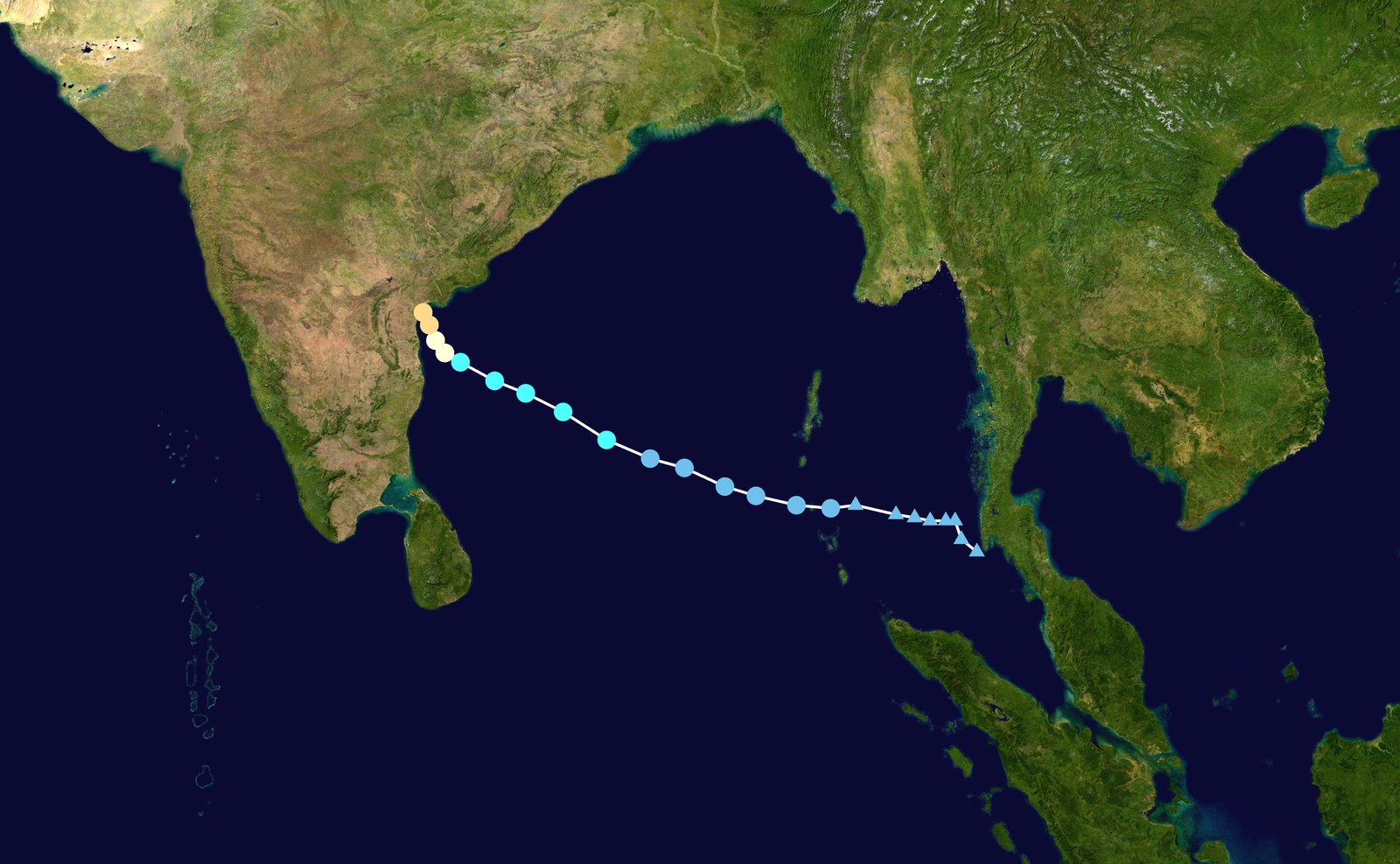

Murasu — a name contributed by India meaning "war drum" in Tamil, The Hindu reported — formed as a low-pressure area over the Andaman Sea on 29 October and intensified into a severe cyclonic storm on 1 November as it moved towards the Andhra coast. It is the second cyclone to hit the state in less than a week, after Arnab crossed the coast near Narsapur on 28 October. The open questions now are how far the damage bill runs once the rain stops, and whether the final toll stays at the zero deaths reported so far. Landfall was still in progress at the time of publication; Europe Unfolded will report confirmed updates as they come.
Updates & corrections
Published 3 November 2026.
Landfall was still in progress at publication; this article will be updated when the India Meteorological Department confirms it is complete. No corrections have been made.
Sources
- The Hindu live updates, 3 November 2026, on the landfall commencing at 1am near Ongole, the observed maximum sustained winds of 110 to 120 km/h at the landfall point, the 1:30am and 3am positions, and the 5:30am update putting the centre 20 km from Ongole with completion expected in another two hours: thehindu.com
- The Hindu live updates, 3 November 2026, on the 5:30am update and the expected completion of landfall: thehindu.com
- Indian Express, 3 November 2026, on the landfall near Kothapatnam close to Ongole, hundreds of trees uprooted in Nellore, Prakasam and Bapatla, low-lying areas inundated, no fallen power poles and no disruption to supply, and the chief minister's 3:30am teleconference: indianexpress.com
- India TV, 3 November 2026, on the India Meteorological Department's wind speeds and storm-surge forecast of 1.0 to 1.5 metres, heavy rainfall over the next 12 hours, waterlogging in Vijayawada, and the chief minister's zero-casualty priority: indiatvnews.com
- Transclew live updates, 3 November 2026, tracking the India Meteorological Department's posts on X: landfall beginning at 1am, the eye touching the coast at 4:16am and entering the coast at 5:08am, and the centre expected to finish crossing close to Ongole: transclew.com
- India Meteorological Department fishermen's warning, 3 November 2026, 6:00am IST, on winds easing through Tuesday and fishermen advised not to venture along or off the Andhra coast until the afternoon of 4 November: mausam.imd.gov.in
- Al Jazeera, 2 November 2026, on about 2,000 people evacuated on Monday and plans to move about 30,000 people in total, according to Prakhar Jain of the Andhra Pradesh State Disaster Management Authority speaking to Reuters: aljazeera.com
- Cyclone Murasu, Wikipedia, on the storm forming as a low-pressure area over the Andaman Sea on 29 October and intensifying into a severe cyclonic storm on 1 November: en.wikipedia.org